DIAGRAMMATIC MAP © 2005
Diagrammatic Map, 2005
Digital print on dibond, aluminium tape, iron letters.
2100 x 200 x 250 cm.
Plaza del Pueblo, Alcobendas, Madrid
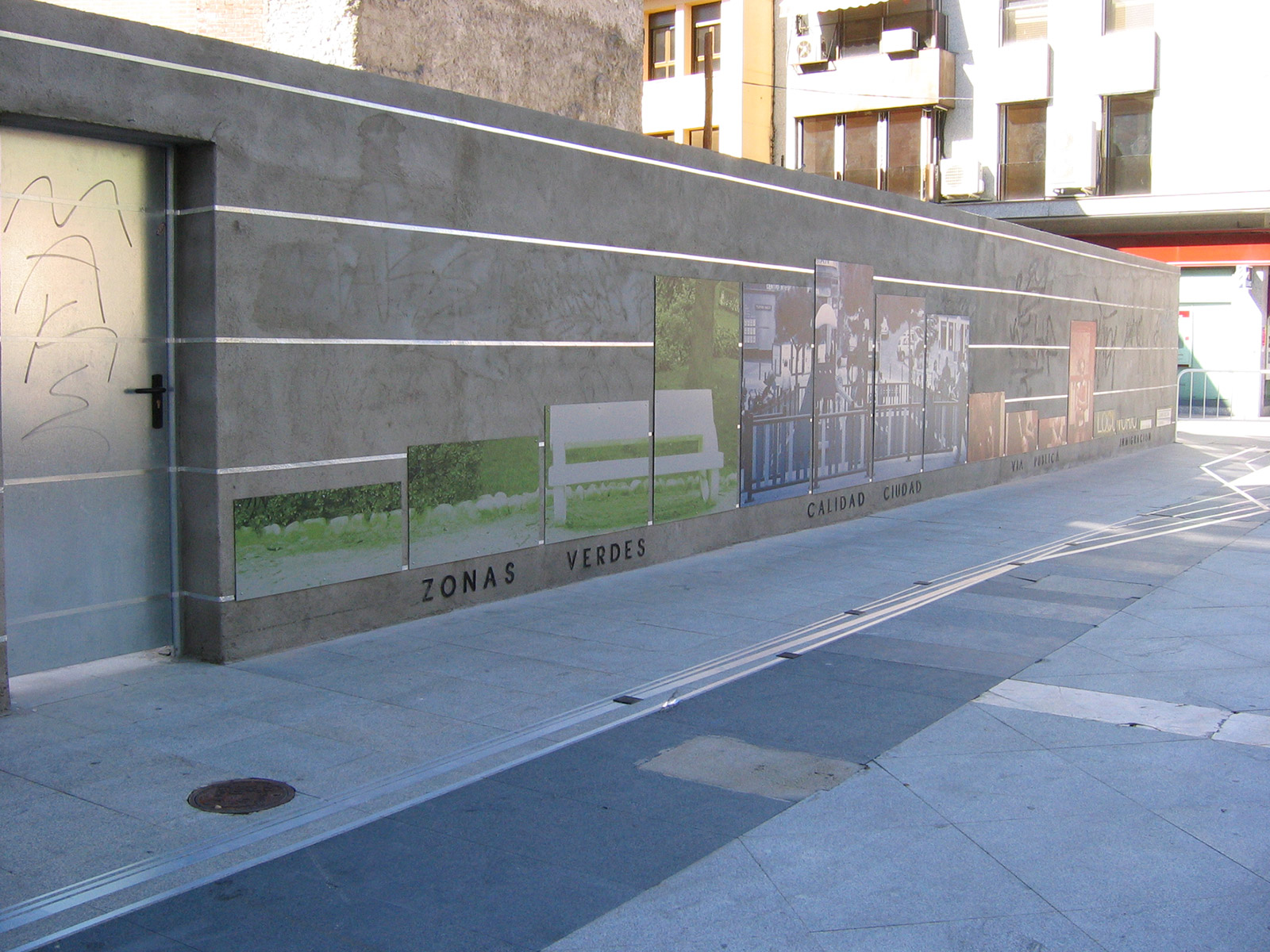
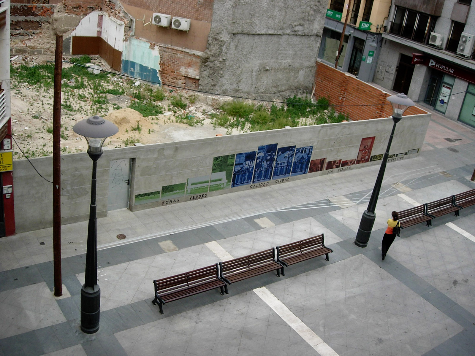
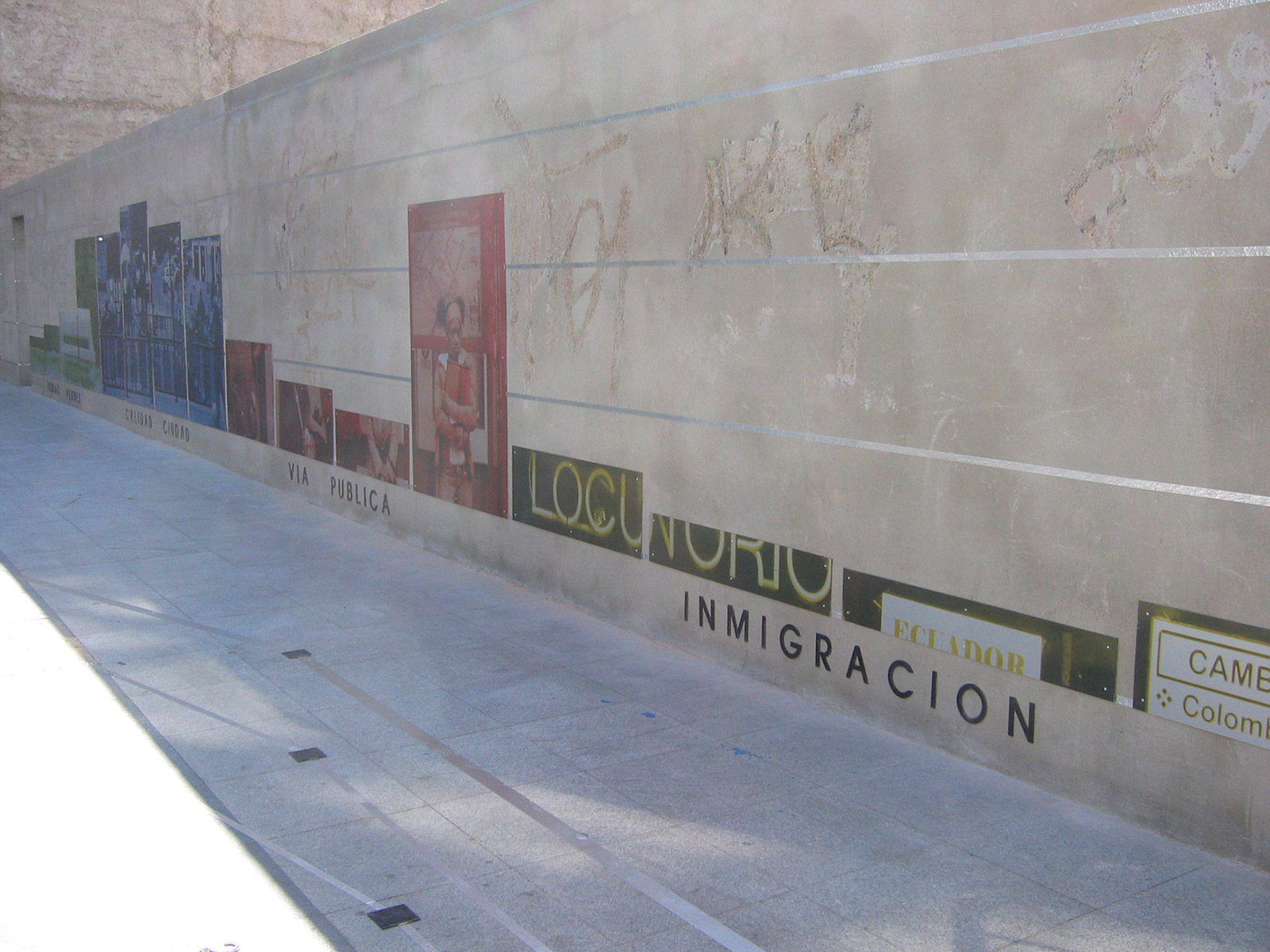
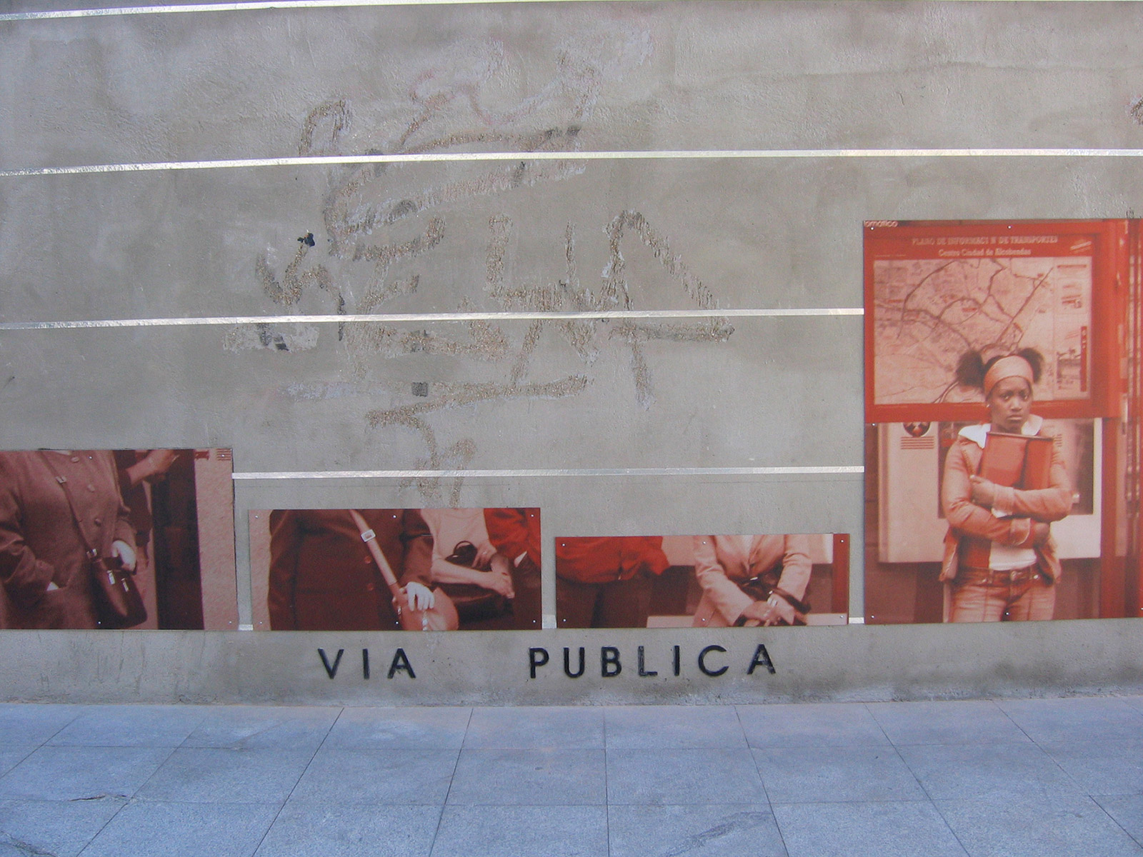
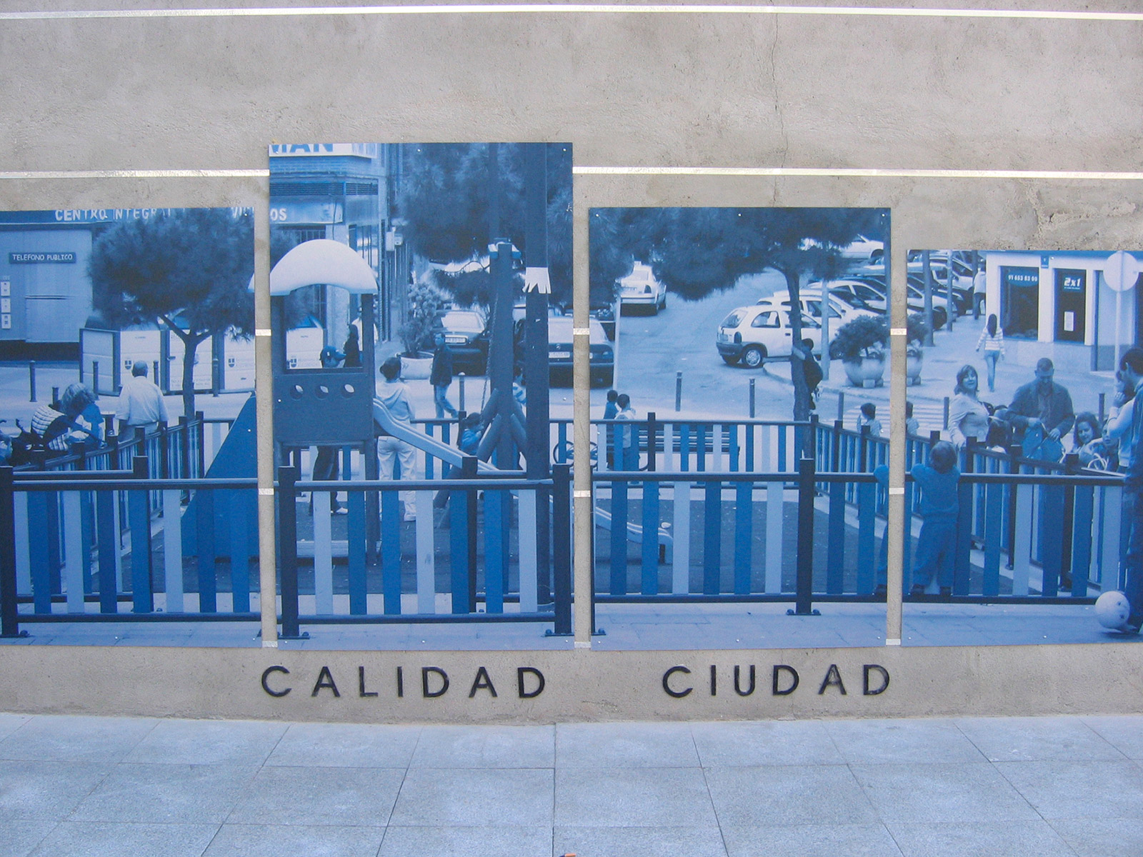
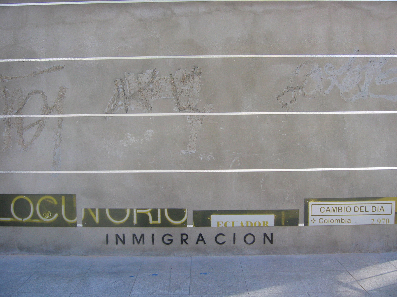
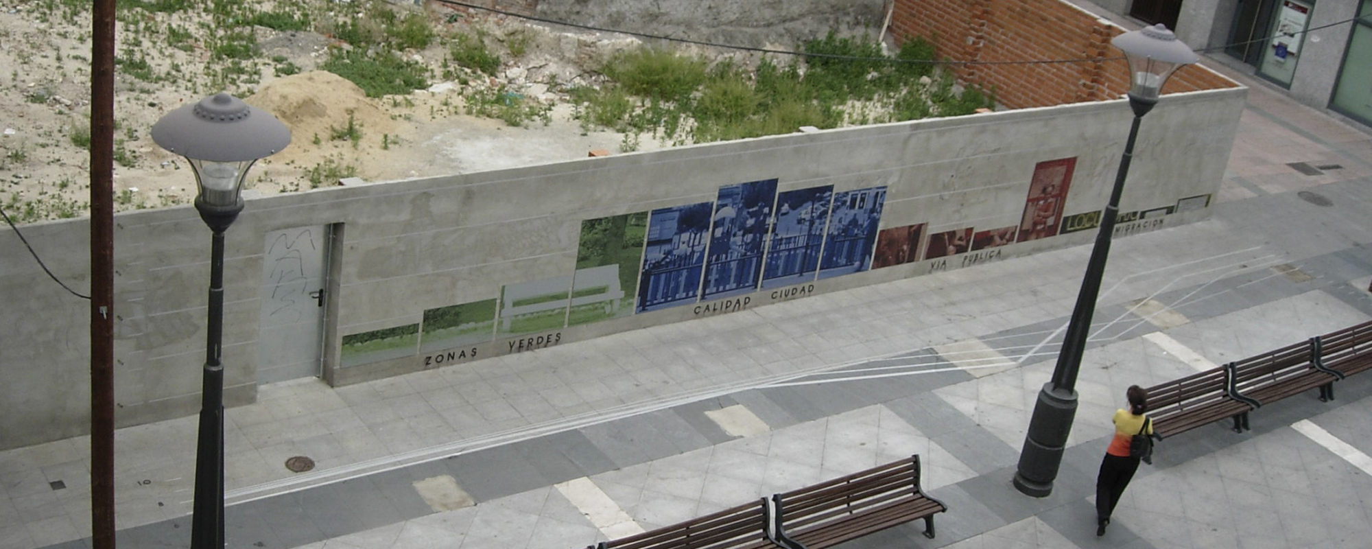
Diagrammatic Map is a visual and plastic interpretation of the opinion that the people of Alcobendas have about their city, derived from the surveys of the Quality of the City documents that the research department of the City Council of this municipality elaborates every year.
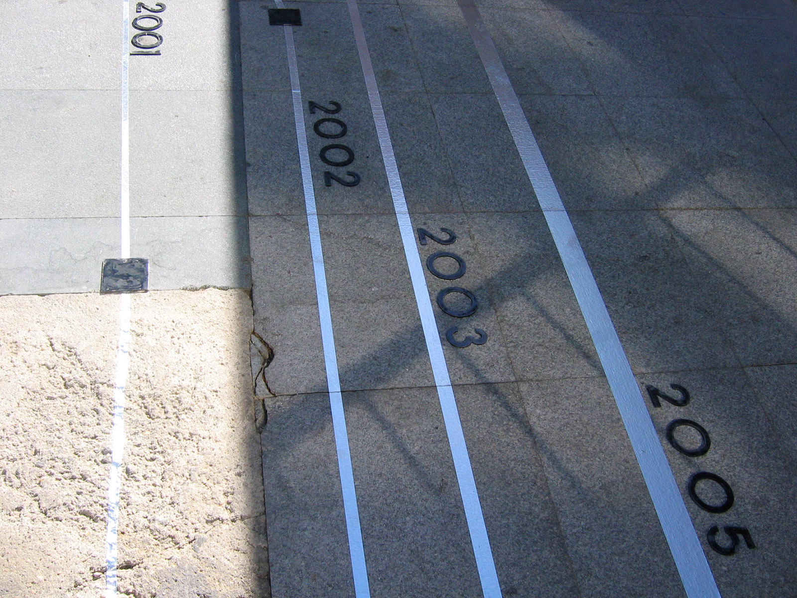
Conceptually, Diagrammatic Map is articulated in two directions. The vertical one, which uses the plan of the wall located in the Town Square, where the parameters of green areas, quality of the city, public roads and immigration are interpreted in percentages. The information, extracted from the series of Working Documents published by the Alcobendas City Council, is interpreted in coloured graphs, in the form of columns, according to the neighbourhoods that currently make up the municipality: Centre, Ensanche, North and Urbanisations. Each concept dealt with has as a background a photographic image related to it, taken from the streets of the city and digitally printed on aluminium. The other direction, the horizontal one, contains historiograms that translate the information on the wall and articulate it on the basis of time parameters, on a scale of 1 to 10. The superimposition of different years, 2005, 2003, 2002 and 2001, draws metallic lines on the pavement which, by overlapping each other, generate a plastic cartography, a kind of conceptual map.
CREDITS ::
Conceptualisation: Esther Pizarro
Production: Esther Pizarro
Location: Plaza del Pueblo, Alcobendas, Madrid
Temporary intervention created as part of the exhibition "Urban Art", organised by the Servicio de Artes Plásticas del Ayuntamiento de Alcobendas, Madrid. May 05