DATASCAPE © 2016

Datascape, 2016
Borosilicate tube and rod, dye water, wood fibre
800 x 450 x 350 cm (h)
Fundación Metrópoli, Ecobox, Alcobendas, Madrid

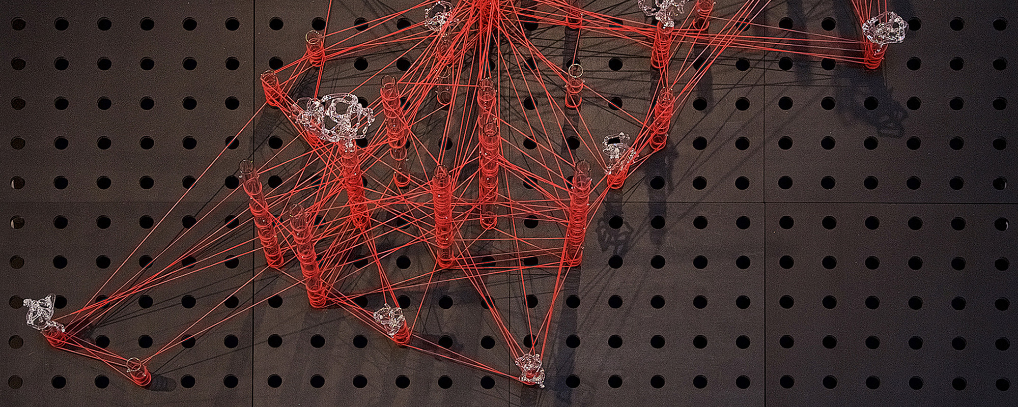
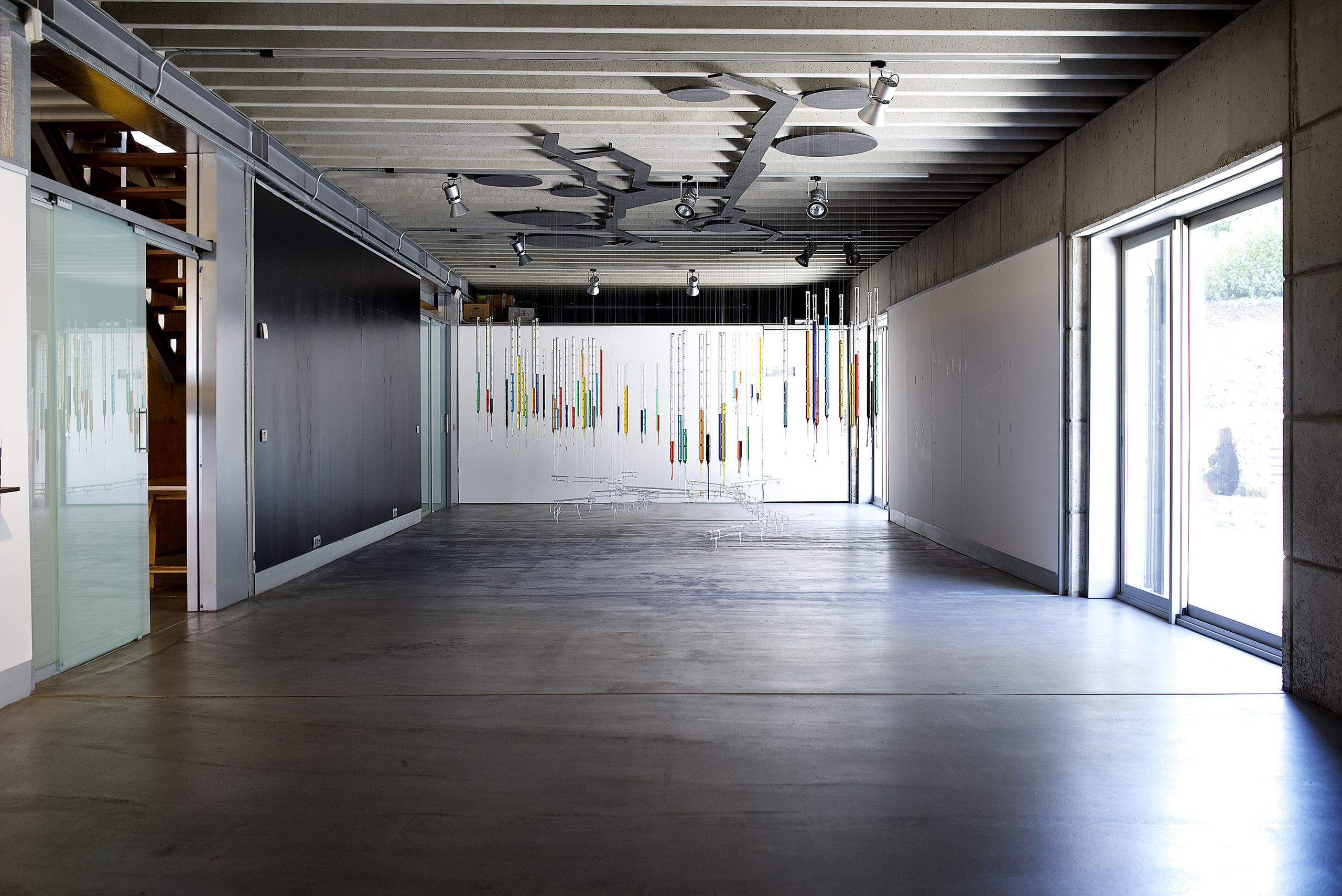
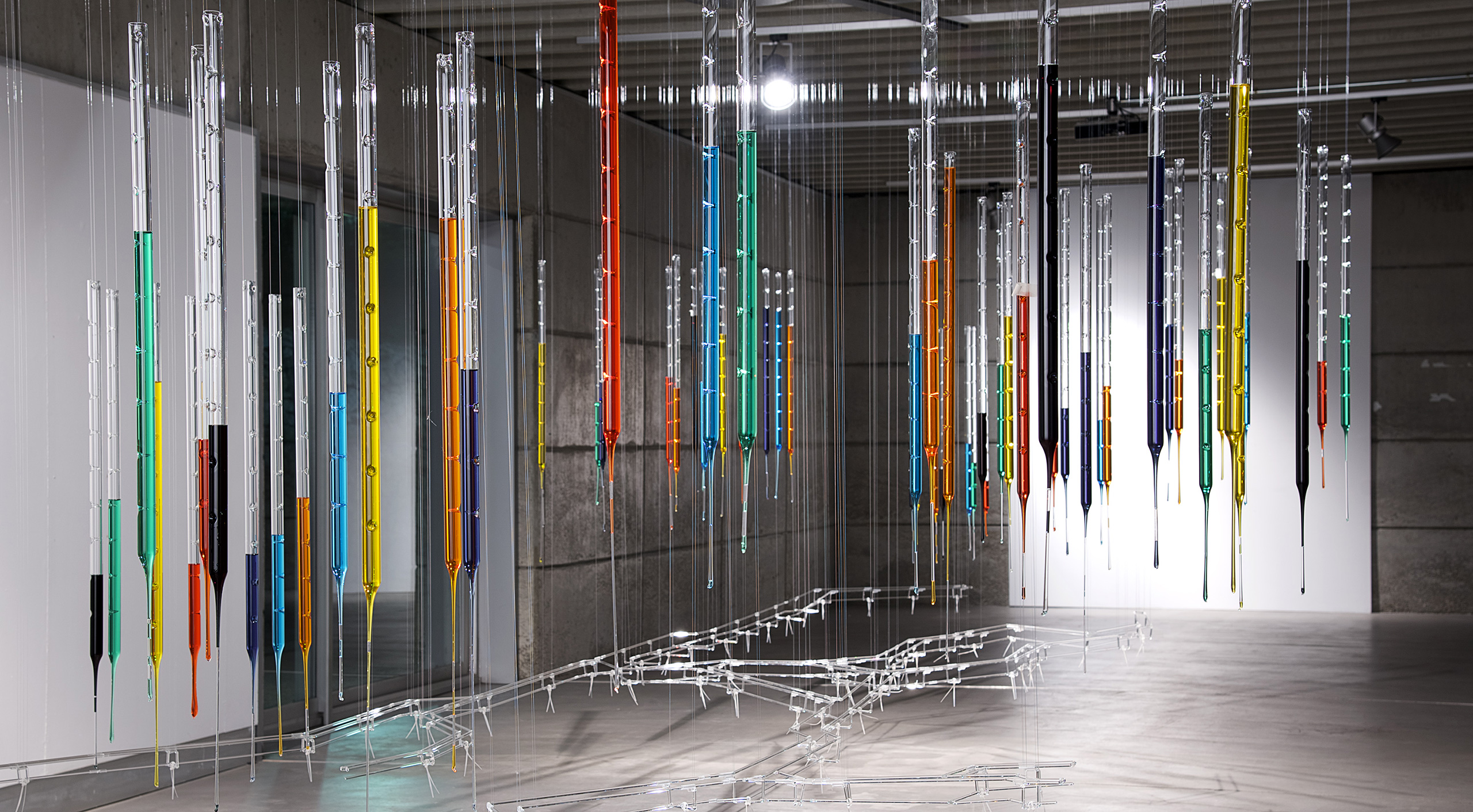
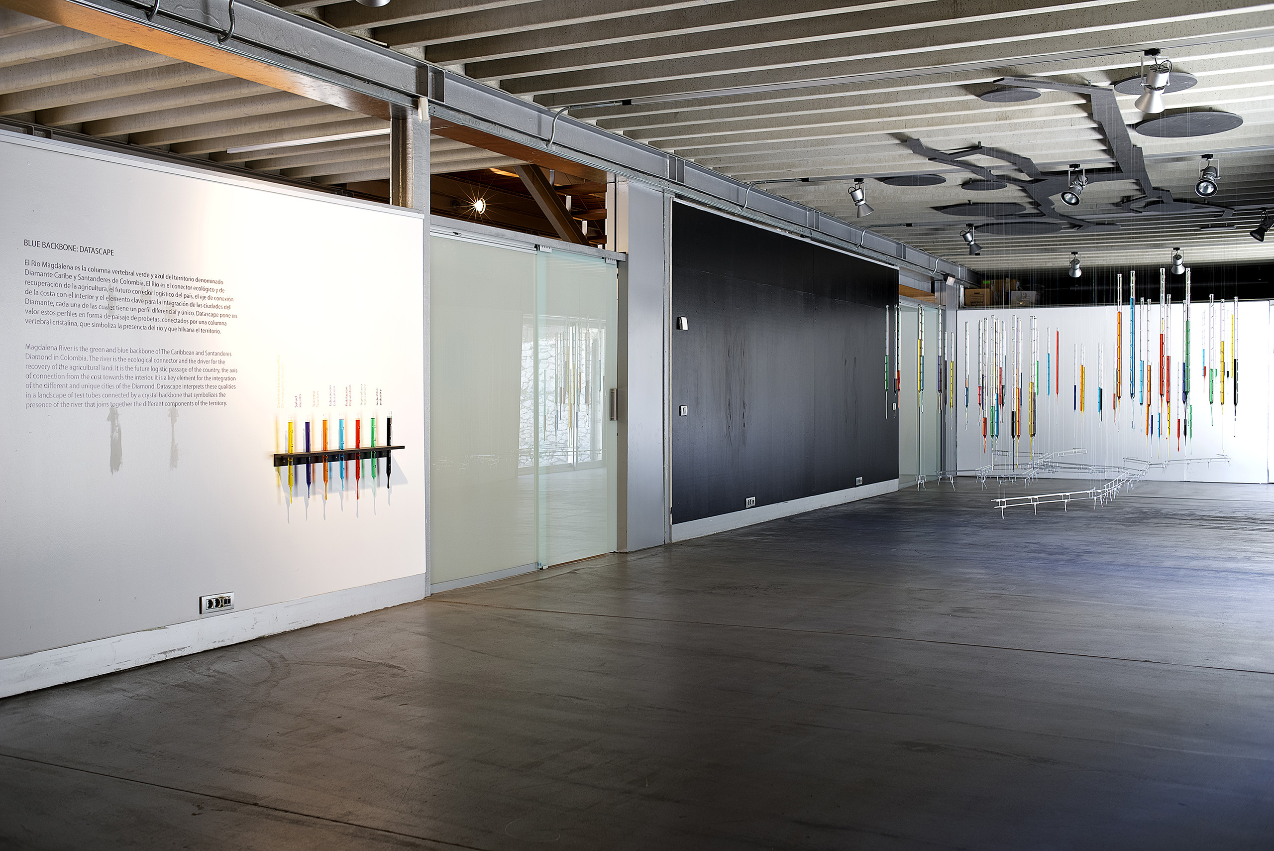
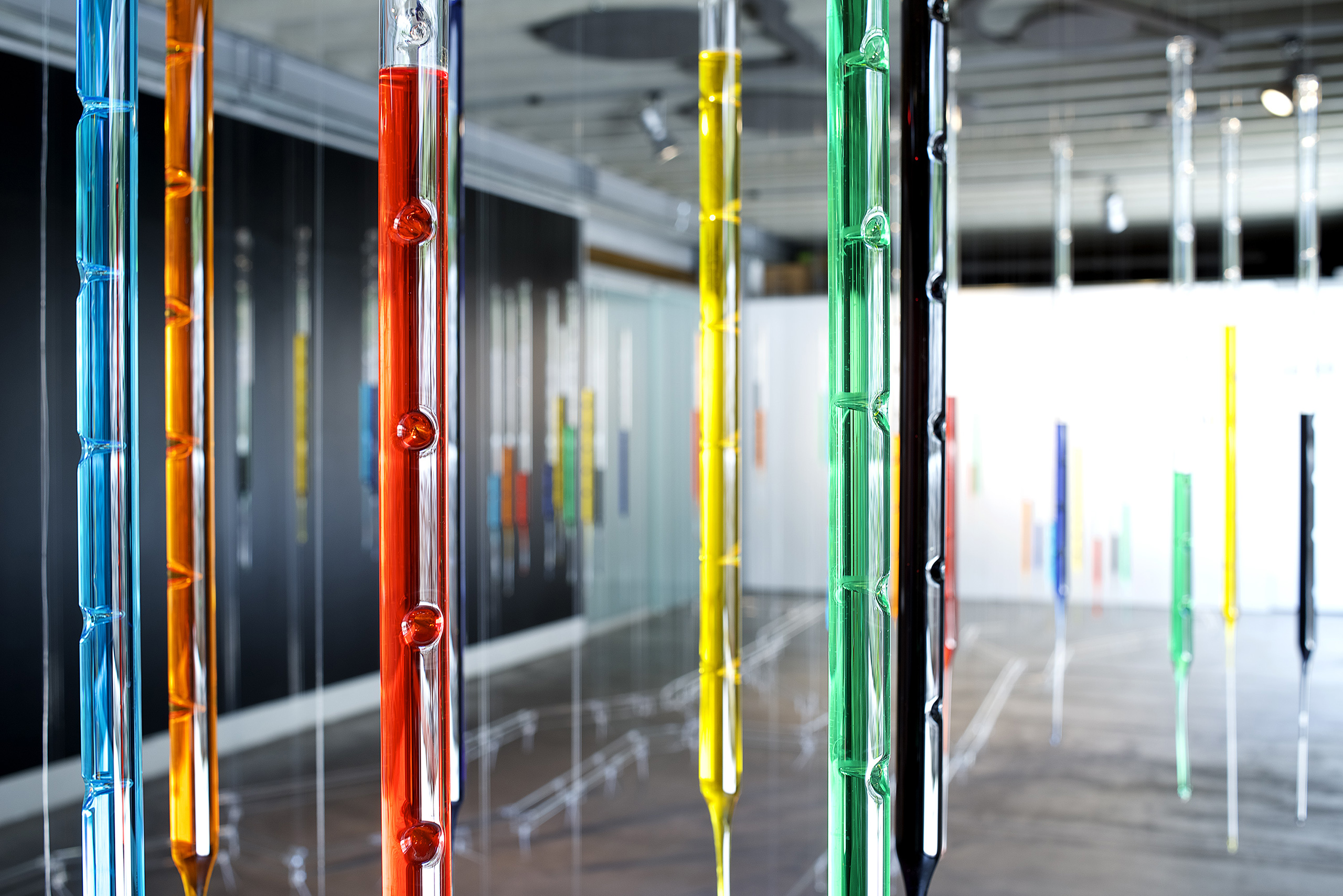
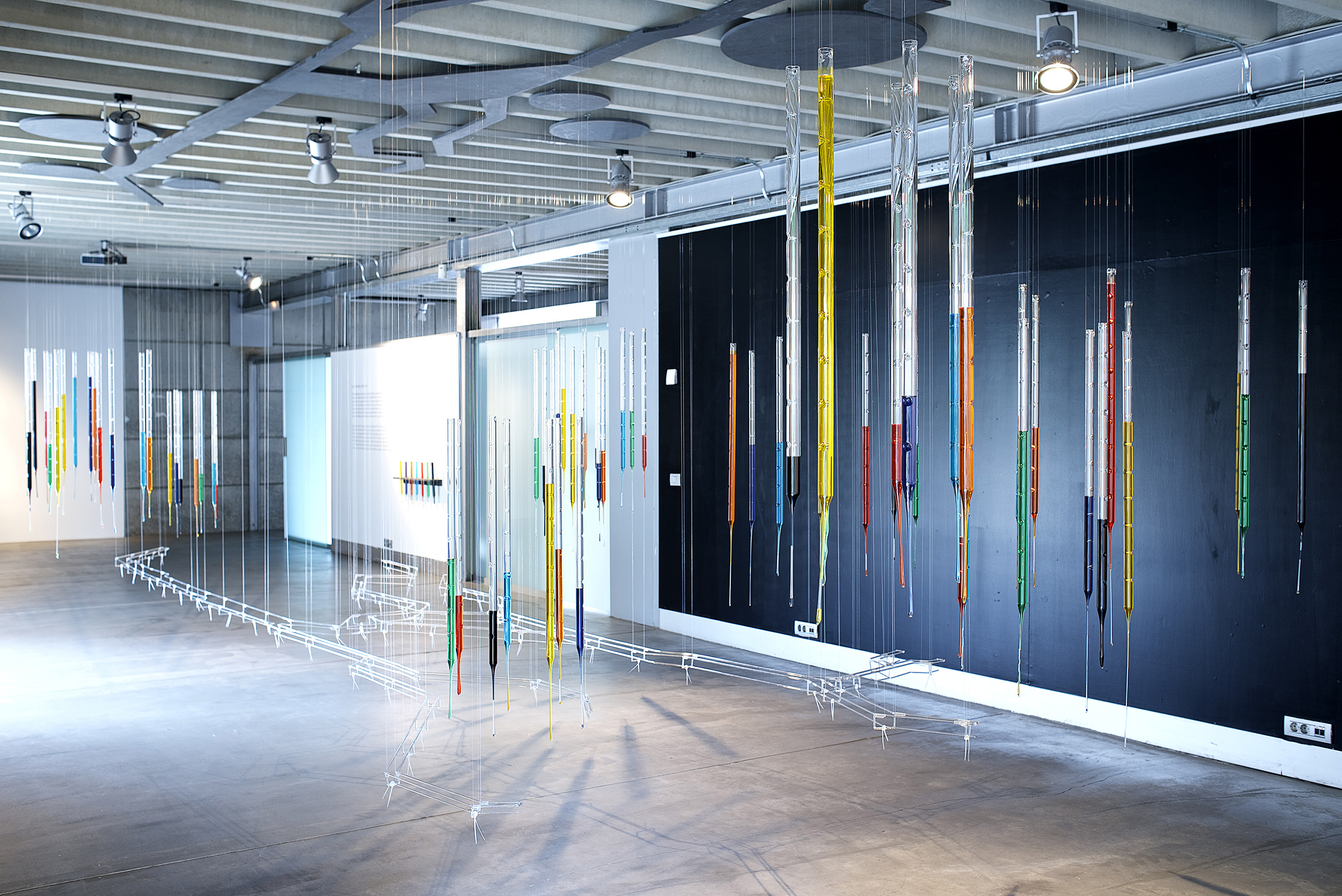
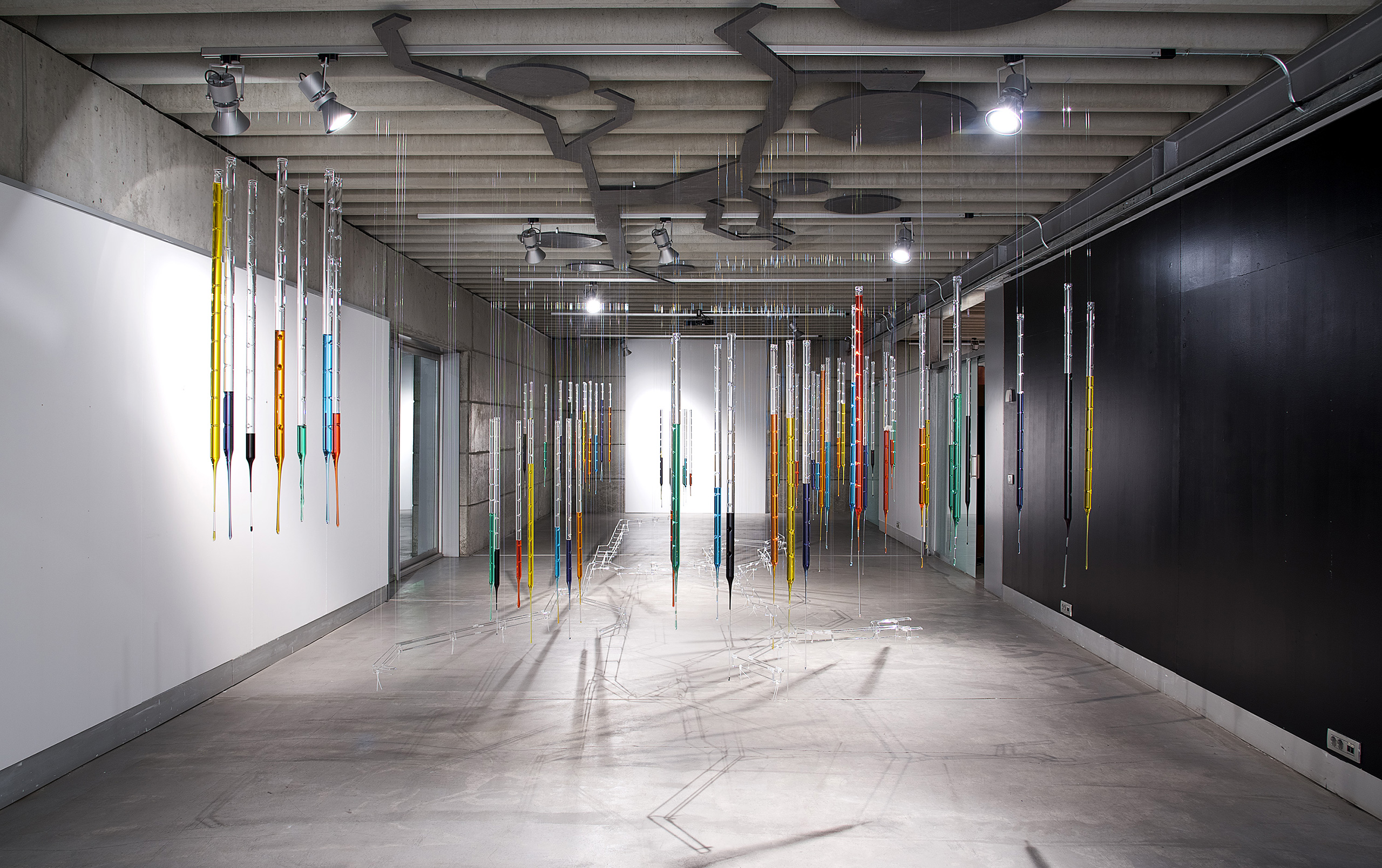
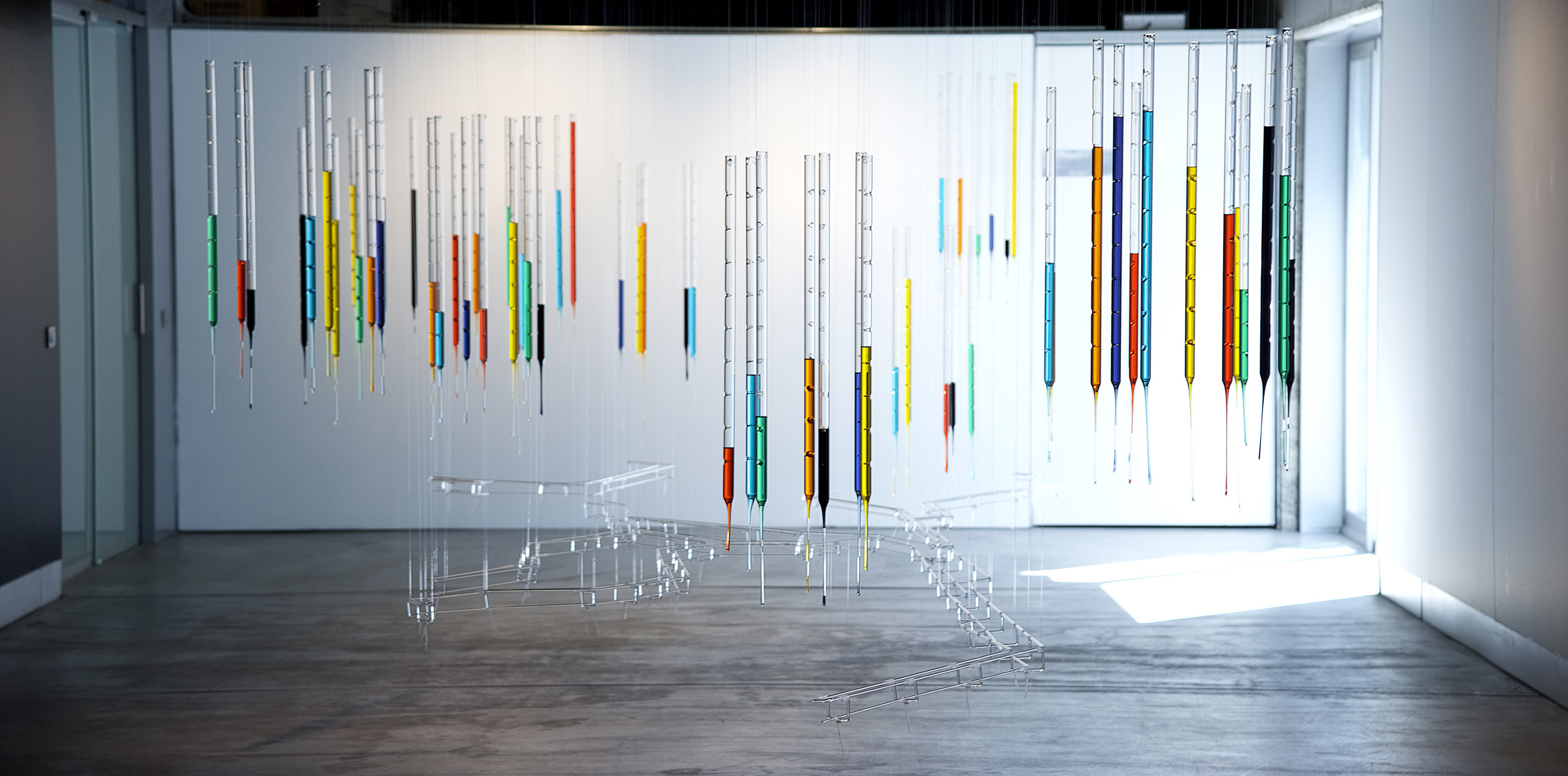
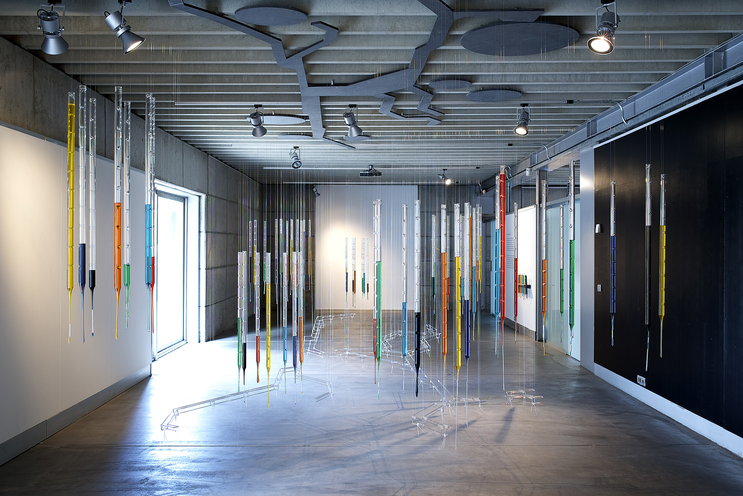
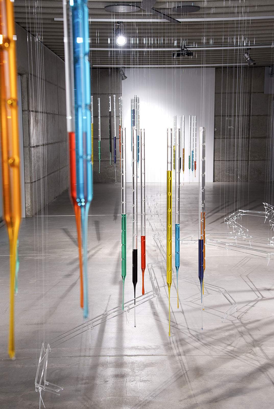
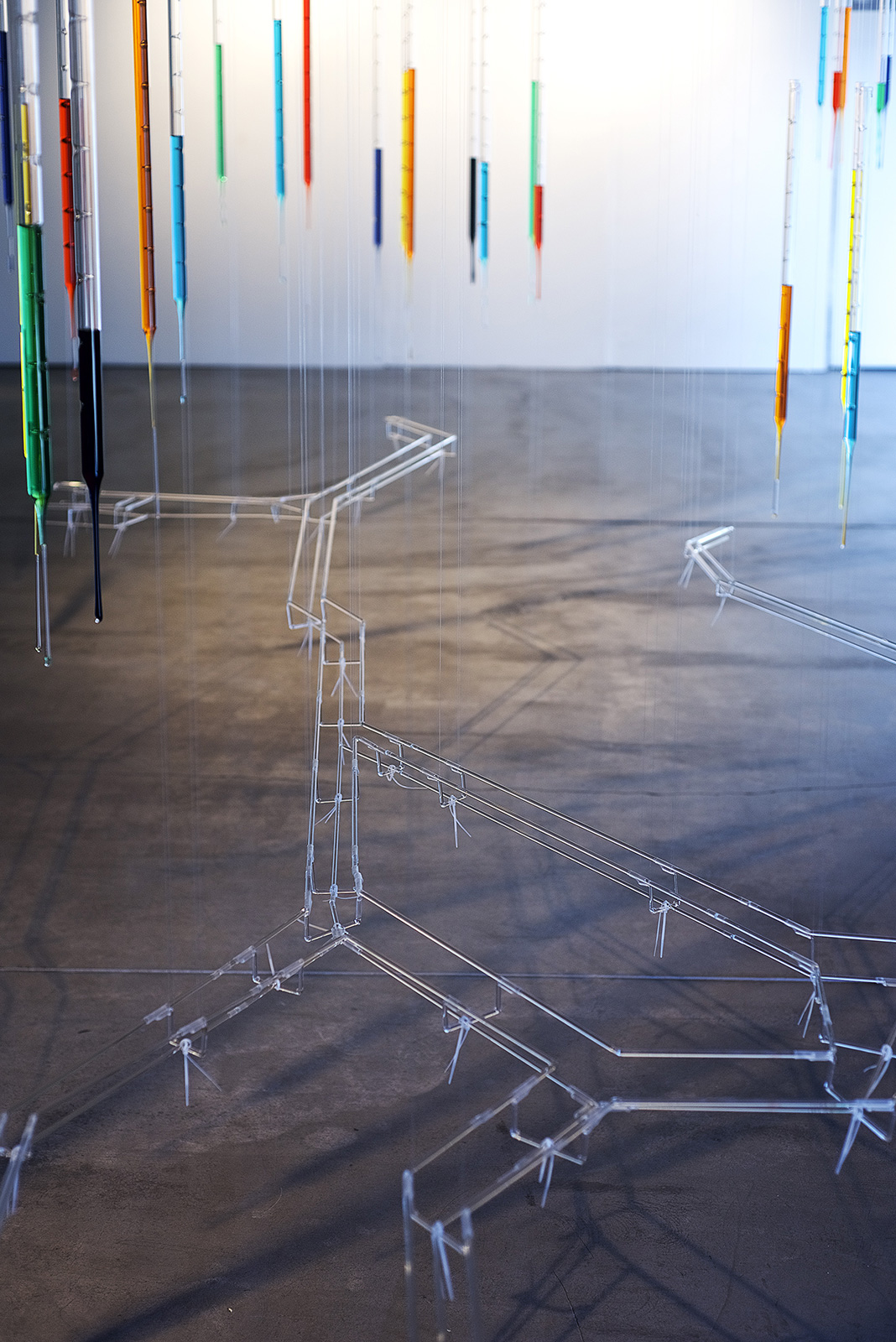
Datascape visualises the existing urban profiles of a city, territory or geographical area in the form of a three-dimensional graph. Seven urban variables (population, population growth rate, education, health, tourism, industry and agriculture) define a method, applicable to any urban environment and scalable in terms of its spatial dimensioning, which focuses on the complex visualisation of data that gives each city a unique and differentiated profile. This installation highlights these variables in the form of a test-tube landscape, thus emphasising the experimental and laboratory character that every landscape possesses. The data respond to real studies developed by Fundación Metrópoli, in the Colombian territory known as the Caribbean Diamond and Santanderes, where the ten cities subject to the study have been delimited. A crystalline spine, which symbolises the presence of a river, the Magdalena River, threads the territory. The river is the ecological and agricultural recovery connector, the future logistical corridor of the country, the axis connecting the coast with the interior and the key element for the integration of the cities of the Diamante.


CREDITS ::
Conceptualisation: Esther Pizarro / Fundación Metrópoli
Production: Esther Pizarro Studio
Funding: Project realized with the support of Knowlege Partner, Fundación Metrópoli

EXHIBITED IN ::
Fundación Metrópoli, Ecobox. “Mapping complexity. Supercities”. Comisariado: Ana Gorroño. Alcobendas, Madrid, 18/02/2016 al 04/03/2017
ASSOCIATED CATALOGUE ::
Pizarro, Esther (2017). Catálogo exposición: Mapping Complexity. Supercities, La inteligencia del Territorio. Textos: Ana Gorroño, Félix Ruiz de la Puerta, Esther Pizarro, Alfonso Vegara. Extensión: 60 páginas. Idioma: español. Formato: 24x21 cm. Encuadernación: rústica. Edita: Fundación Metrópoli. ISBN: 978-84-617-7921-5, DL: M-1464-2017